 geoGPS
Since 2011 developed and available on Google Play
Online from GNSS RTK surveying to a cloud map and a QGIS project
geoGPS is a system for mapping and collecting spatial data in the field. Measure with an app connected via Bluetooth to a GNSS RTK receiver, your data syncs automatically to geoGPS Cloud, and you view it in the Web Panel or edit it in QGIS.
App for Android devices. Using the system requires an active subscription – new organizations get 7 days free.
Download the brochure (PDF, 4 pages)How it works
- 1Measure in the fieldPoints, lines and areas from the phone GPS or an RTK receiver, plus photos and notes.
- 2Sync with geoGPS CloudEvery measurement goes straight to the cloud – no manual file transfers.
- 3Web Panel and QGISMap view, layers, export and further work in QGIS.
- 4TeamworkThe whole team sees the organization's projects and objects: everyone edits their own and views the others'.
One system – four components
All components share the geoGPS Cloud database, so data entered in one place is immediately available in the others.
Mobile app
The geoGPS Android app for field data collection, GNSS RTK measurements, photos and forms.
geoGPS Cloud
The central database and server platform. Stores and syncs projects, layers and attachments for your whole organization.
Web Panel
Browser access to your data: a map with layers, point photos, user and organization management, data export.
QGIS plugin
An add-on for the free QGIS software – open and edit geoGPS Cloud data directly in your GIS environment.
geoGPS plugin (ZIP)QGIS 3.22+ and QGIS 4 · install via Plugins → Manage and Install Plugins → Install from ZIP.
Download QGIS (qgis.org) →Who it’s for
Built for professionals who demand precision
geoGPS is a working tool for specialists for whom every centimetre, data reliability and efficient teamwork matter – in the field and in the office. This is not a recreational GPS app.
Construction and design
Stakeout, distance and area measurements, with data ready for further work in QGIS.
Land surveyors
GNSS RTK measurements with 1–2 cm accuracy*, stakeout, 5,000+ EPSG coordinate systems and 100+ geoid models for heights.
Forestry and nature conservation
Inventory of stands, habitats and natural features – with forms, photos and precise positions.
Utilities and infrastructure
Asset inventory: poles, manholes, valves and connections, with photo documentation and feature attributes.
Real estate and land management
Map plots, boundaries and property assets in the field – on top of cadastral maps and orthophotos from public WMS/WMTS services.
Local government
Registers of greenery, street lighting, roads and municipal assets – shared with the whole team in the Web Panel.
Farmers and agricultural advisors
Measuring field and crop areas, farm parcel boundaries and documenting crop damage with photos and location.
Geologists and hydrogeologists
Locating boreholes, outcrops and monitoring points with descriptions, photos and elevation – in one project database for the whole team.
Real estate agents
Checking the plot on site against cadastral maps, measuring its area and documenting the property with photos for the listing.
What professionals demand – and what they get with geoGPS
We built geoGPS around the real requirements of field work: accuracy, compliance with national reference systems, teamwork and data security.
- Centimetre accuracy – GNSS RTK receiver and NTRIP corrections
- Coordinate and height systems – over 5,000 EPSG projected coordinate systems worldwide and 100+ geoid models from 20+ countries, including global EGM96 and EGM2008
- Stakeout and measurement – feature stakeout, distances and areas
- Reference data – public WMS/WMTS services – orthophotos, cadastral and topographic maps
- Teamwork – Manager and Employee roles, one shared organization database
- Professional GIS – QGIS plugin – no manual file exports
- Security and GDPR – EU data, HTTPS, two-step sign-in, data processing agreement
Architecture
From field to desk – in real time
The GNSS RTK receiver feeds positions to the app, the app syncs measurements with geoGPS Cloud, and your whole team sees them in the Web Panel and QGIS – on top of open public data from WMS/WMTS services.
Data structure
How data is organised
Data is stored hierarchically: the largest set is the organisation, which contains the data sets of individual employees; each employee’s set contains their projects, and projects contain the survey objects. Employees can see each other’s work, but cannot edit or delete it – everyone changes only their own data. Reference layers are available independently of this structure and can be used as a background for any project.
All data is available online – from the mobile app, the Web Panel and the QGIS plugin.
- Objects (point, line, area)
- Photos
- Objects (point, line, area)
- Photos
+ more projects
- Objects (point, line, area)
- Photos
+ more projects
+ more employees of the organisation
- WMS / WMTSbase maps and orthophotos
- GMLvector data in GML format
- Land parcelsparcel boundaries and numbers (ULDK GUGiK)
- MPZPlocal zoning plans
- Real estate price registertransaction prices (RCN)
Key features
Tools for surveyors, foresters, utility crews and every team that works with data in the field.
- 1–2 cm accuracy* with an optional external RTK GNSS receiver.
- NTRIP corrections – RTK/DGPS correction streams supported in the app.
- 5,000+ EPSG coordinate systems and 100+ geoid models for height conversion.
- Layers and projects – points, lines, areas, forms and attributes.
- Photos and notes attached to surveyed features.
- Organizations and teams – Manager and Employee accounts, roles and company-wide data view.
- QGIS integration – further analysis and editing in a professional GIS.
* 1–2 cm accuracy is achievable with an external GNSS RTK receiver and NTRIP corrections in favourable observing conditions. Actual accuracy depends on the receiver class, correction quality and site conditions, among other factors, and is not guaranteed – see § 4 and § 7a of the Terms of Service.
Surveying, stakeout, volumes and area settlement
Work in the field, in the geoGPS mobile app, on data from the active project. Volume measurement and area settlement require an active subscription.
Object surveying
Survey points, lines and areas from your current position: the app collects the set number of readings, shows repeatability and saves coordinates, heights and accuracy parameters. Objects you can't reach can be added by picking them on the map.
Object stakeout
Pick a point, line or area, and the app shows the distance to the target and guides you there. On lines and area boundaries, stake out a picked point or the nearest one, updated live. At the target you can save a check measurement.
Surface stakeout
The app spans a surface over the heights of an area's vertices and shows ΔH live: the difference between your height and that surface. Save the result as a check measurement with the area name and the Δh value.
Volume measurement
The volume between two surfaces, split into cut, fill and balance. Each surface comes from points with a height H or from a constant height level, and the triangle mesh can be corrected by hand. Output: a PDF report and a 3D DXF file.
Area settlement
Settle areas against one main area: see the common part of each, their total and what remains not settled. Overlapping areas trigger a warning. Output: a PDF report with a balance and a DXF drawing.
See geoGPS
geoGPS in action
This is what working with geoGPS looks like – in the field, in the browser and in QGIS.
Pricing
Plans and pricing
geoGPS is a monthly subscription. Choose a plan by the number of accounts in your organization – change or cancel it at any time.
Package A
Package B
Package C
Individual package
- geoGPS mobile app for Android
- Data storage in geoGPS Cloud
- Web Panel
- geoGPS plugin for QGIS
- Prices for packages A, B and C include tax and are shown in the app before purchase – payments are handled by Google Play.
- The individual package is billed by VAT invoice.
- Every new organization gets a 7-day free trial – no card and no automatic renewal.
- The subscription price does not include a smartphone or an RTK kit.
- A GNSS RTK receiver is optional and sold separately: sklep.encom.pl.
GNSS RTK receivers
-
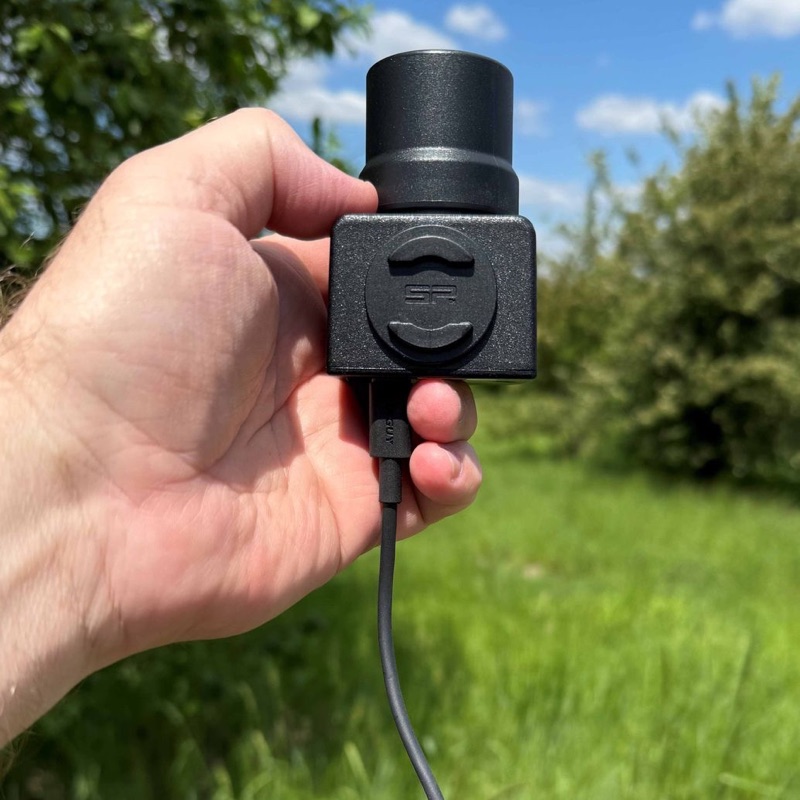
geoGPS RTK – mini version
The most affordable kit, mounted on a smartphone.
PLN 4,500 incl. VATView in shop -
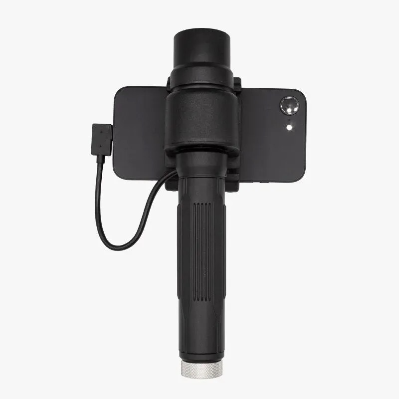
geoGPS RTK handheld kit with ZED-X20P
Handheld kit with an option to mount on a survey pole.
PLN 6,400 incl. VATView in shop -
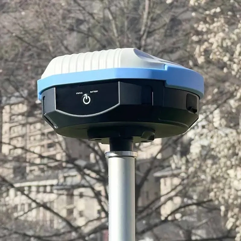
geoGPS RTK survey kit with ZED-X20P and tilt compensation (IMU)
Measure much faster – you no longer need to hold the survey pole vertical.
PLN 8,400 incl. VATView in shop
How to buy a subscription
The whole purchase happens in the mobile app or in the Web Panel – from registering your organization to paying in Google Play or by VAT invoice (KSeF).
-
Install the app
Download geoGPS from Google Play on your Android phone or tablet.
GET IT ONGoogle Play -
Register your organization
Enter the company name (optionally tax ID and address) and the first user’s details – they get the Manager role. Sign-in details arrive by e-mail.
-
Accept the terms
During registration you accept the Terms of Service and review the Privacy Policy.
-
7 days free, then choose a plan
After registration, a new organization gets a free 7-day subscription. After that period, choose a suitable plan (Package A, B or C) in the app or in the Web Panel, or delete your data. You can also order an individual package billed by VAT invoice – write to office@geogps.cloud.
-
Add your team
The Manager creates employee accounts on the “My Account” screen. Each person receives sign-in details by e-mail.
-
Work in the field and office
Measure in the app and review data in the Web Panel or in the free QGIS software with the geoGPS plugin (ZIP).
Sign in
Individual package: in the app, on the “Subscriptions” screen, choose “Individual package”, enter the number of accounts and a contact phone number – we will prepare an offer. You can also e-mail office@geogps.cloud.
Managing your subscription: it renews automatically every month. Turn it off in Google Play (Profile → Payments & subscriptions → Subscriptions) – access remains until the end of the paid period. Uninstalling the app does not cancel the subscription.
FAQ
Frequently asked questions
Short answers to the questions we hear most often from surveyors and field teams.
What is geoGPS?
geoGPS is a system for GNSS RTK surveying and field data collection made by ENCOM Sp. z o.o. (Kraków, Poland). It consists of an Android app, the geoGPS Cloud database, a browser-based Web Panel and a plugin for QGIS. Measurements sync automatically, so the whole team works on the same data in the field and in the office.
How long has the geoGPS app been around?
The geoGPS mobile app has been developed since 2011 and has been available on Google Play ever since. Over a decade of continuous development and field experience underpins today’s system with geoGPS Cloud, the Web Panel and the QGIS plugin.
What accuracy can I achieve with geoGPS?
With an external GNSS RTK receiver and NTRIP corrections, 1–2 cm is achievable in favourable observing conditions. Actual accuracy depends on the receiver class, correction quality and site conditions and is not guaranteed. Without a receiver the app uses the phone’s built-in GPS, which is much less accurate.
Which GNSS RTK receivers work with geoGPS?
The app connects via Bluetooth to a dedicated geoGPS RTK receiver from sklep.encom.pl: the mini version (PLN 4,500), the handheld kit with ZED-X20P (PLN 6,400) and the survey kit with ZED-X20P and tilt compensation (IMU) (PLN 8,400), prices incl. VAT. You can also use another receiver, but it requires your own verification.
What devices and software do I need?
An Android phone or tablet for the geoGPS app (Google Play), any web browser for the Web Panel and, optionally, the free QGIS (3.22+ or QGIS 4) with the geoGPS plugin.
How much does geoGPS cost?
geoGPS is a monthly subscription chosen by the number of accounts: Package A (1 account, 1 GB), Package B (2 accounts, 2 GB) or Package C (3 accounts, 3 GB). Prices incl. tax are shown in the app and paid via Google Play. Larger teams can get an individual package billed by VAT invoice. Every new organization gets a 7-day free trial – no card and no automatic renewal. The RTK receiver is sold separately.
Where is my data stored and is it secure?
geoGPS Cloud runs in a data centre in the European Union, certified to ISO/IEC 27001 and ISO 9001, with a 99.9% availability SLA. Connections are encrypted with HTTPS and sign-in is two-step with a one-time verification code. Customers get a GDPR data processing agreement (DPA).
Which coordinate systems and height models are supported?
Over 5,000 EPSG projected coordinate systems and 100+ geoid models from 20+ countries, including the global EGM96 and EGM2008. Public WMS/WMTS services – orthophotos, cadastral and topographic maps – can be used as reference layers.
What can I do in the field?
Survey points, lines and areas, stake out objects and surfaces (with live ΔH), measure the volume between two surfaces (cut, fill and balance – PDF report and 3D DXF) and settle areas against one main area (PDF report and DXF). Photos, notes and attributes can be attached to features. Volume measurement and area settlement require an active subscription.
How do I export data or work in QGIS?
The geoGPS plugin opens and edits geoGPS Cloud data directly in QGIS and exports features to GeoJSON, CSV, TXT, KML and DXF. The Web Panel also offers data export.
How do I cancel the subscription?
The subscription renews every month. Turn it off in Google Play (Profile → Payments & subscriptions → Subscriptions) – access remains until the end of the paid period. Uninstalling the app does not cancel the subscription.
Already have an account?
Sign in to the Web Panel and see your data on the map.