
Stakeout step by step
- Tap Object stakeout and pick a point, line or area on the map.
- For a line or area choose the stakeout mode.
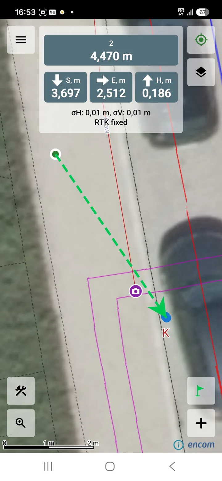
- Walk to the target, following the Distance to point.
- Reaching the target is signaled by a flashing green circle.
Modes for lines and areas
- Tap a point on the object – stake out exactly the point you tap.
- Nearest point on the selected object – the target is recomputed as you move and is always the point of the line or area boundary closest to you.
- Nearest point on the selected surface (area) – for an area with at least 3 vertices.
Surface stakeout
A surface is spanned over the heights of the area's vertices, and the app shows the ΔH to surface: the difference between your height and that surface. Inside the area the reference point is your position. Outside it, it is the nearest point of the area, and the app shows the distance to the area.
SAVE POINT saves a control measurement with the area name and Δh in the description.
Check the height model. If the area heights are in a different height model than the active one, the app warns that Δh includes the difference between the models.
Stakeout settings
In Settings → Object stakeout you can set:
- Target-reached tolerance – the distance at which the point is considered staked out.
- Include heights – the height difference to the target: "+" go higher, "−" go lower.
- Save staked-out point – asks about a control measurement after the target is reached. The description holds the name of the staked-out object and the distance to the target.
Frequently asked questions
Can I stake out objects from a GML file?
Yes, objects from GML layers can be staked out, except for surface stakeout.
How many vertices does an area need for surface stakeout?
At least 3.
Can I stake out with centimetre accuracy?
That requires an external RTK GNSS receiver and NTRIP corrections. Actual accuracy depends on equipment, corrections and site conditions and is not guaranteed.